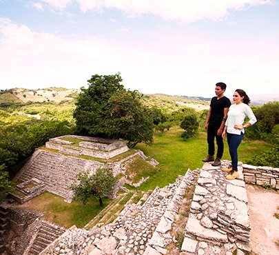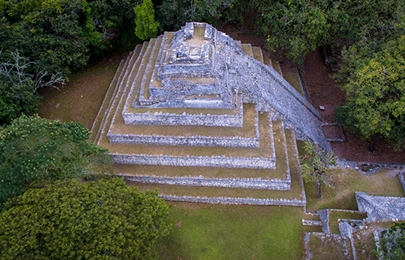
It is located in a series of limestone hills, between 1,600 and 1,700 meters above sea level, in the area of the southern border of the Mayan zone. The main period of its occupation corresponds to the Classic and Early Postclassic periods (approximately between 300 and 1200 years of our era).
Its strategic position, on the route that connects the highlands of Chiapas and Guatemala, allowed it to have access to important commercial networks, as evidenced by the presence of objects that came from long distances such as alabaster vessels, seashells and metals. Tenam Puente is a hybrid toponym: Tenam derives from the Nahuatl tenamitl, "fortress", while Puente refers to the name of an old hacienda whose lands today constitute the Francisco Sarabia community. Some sixty structures make up its core zone, which extends over 30 hectares. The importance of Tenam Puente lies in the fact that it represents the transition from the Classic to the Postclassic and one of the least studied stages of Chiapas archaeology.
How to get there:
From Comitán, take federal highway 190 towards the city of Cuauhtémoc, for approximately 8 km, then take the detour that leads to Francisco Sarabia (2 km). In the southwest of this community is the central area of the pre-Hispanic settlement.
Schedule:
Monday to Sunday from 08:00 to 17:00
cost:
$ 45 MXN per person
For your convenience:
-
Access ticket office
-
module
-
Parking
-
Restrooms
-
Rest areas
-
Small interpretive room in the service
-
Guided tours are offered occasionally
Activities:
360 tour
Comitán de Domínguez, Chiapas
Ocozocoautla de Espinosa, Chiapas
National Macabil and Tenguayaca Sport Fishing Championship
Chiapa de Corzo, Chiapas
Zinacantán, Chiapas
Tuxtla Gutiérrez, Chiapas


