
Chiapas
Chiapas, along with Tabasco and the Yucatan Peninsula, is part of the Central American isthmus belt. It is located in the southeast of the republic, on the border with Guatemala, with which it borders to the east, along 654 kilometers, or 67.77% of the total 965 kilometers.
Nineteen of the twenty-one municipalities on Mexico's southern border are Chiapas. The border is marked in part by the Suchiate and Usumacinta rivers. To the north, it borders Tabasco and to the west, Veracruz and Oaxaca. The Pacific Ocean is its southern border.
It has a territorial surface of 74,415 km2, which places it as the eighth largest state of the Mexican Republic, representing 3.8 of the total surface of the country.

Weather
The climate in Chiapas is determined by the altitude.
The climatic diversity corresponds to the topographic diversity, so in general terms there are warm climates below 1000m altitude, semi-warm climates between 1000m and 2000m, and temperate climates above 2000m, only at the top of the Tacaná there is a really cold climate.
Due to the rainy season, there are areas with summer rains.
In Chiapas are the two poles of maximum rainfall in Mexico with more than 4000 mm of rain per year: in the coffee-growing highlands of Soconusco and in the northern highlands. In contrast, the central depression, the coastal zone closest to the ocean and the valley of Motozintla receive less than 1000 mm per year.
Land of contrasts
The state of Chiapas has seven major physiographic regions: the Pacific Coastal Plain, the Sierra Madre de Chiapas, the Central Depression, the Highlands, the Eastern Sierra, the Northern Sierra and the Gulf Plain.
The Pacific Plain
It runs parallel to the ocean and is crossed by short, fast-flowing rivers during the rainy season, the largest of which is the Suchiate, which drain into estuaries and coastal lagoons.
In the Sierra Madre
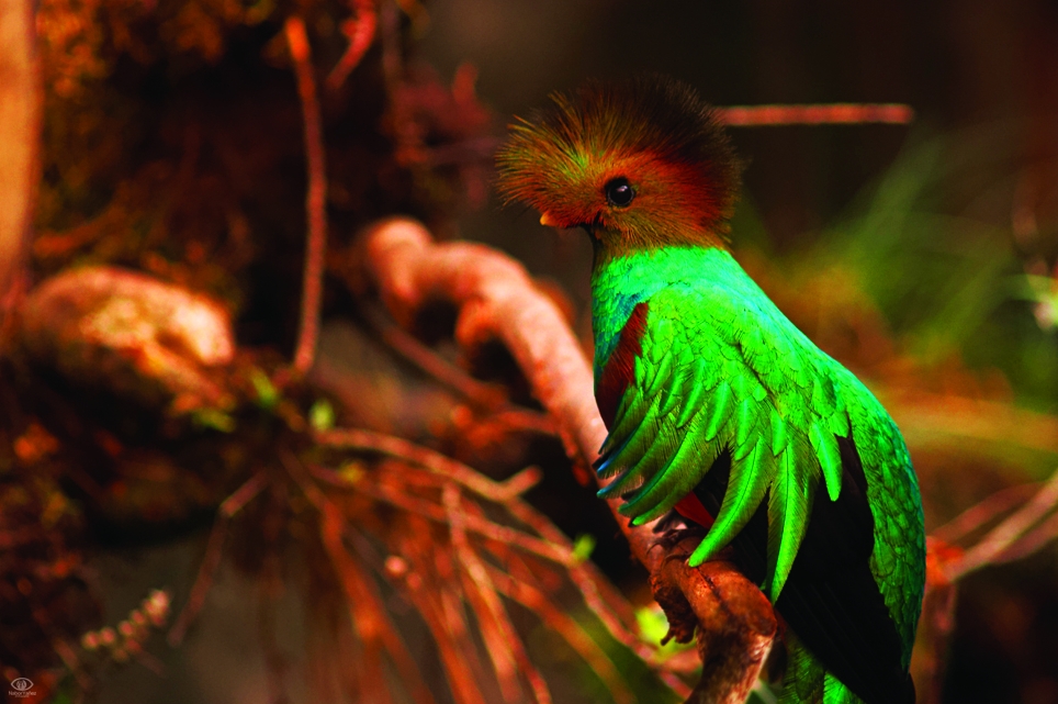
Younger sediments and volcanic rocks settled on a very ancient geological base. This mountainous alignment has a great diversity of landforms, climates (from warm to cold, from very humid to semi-dry), vegetation (low, high and medium jungles, cloud forests, pine and oak forests) and fauna. The sierra is located in the southeast, and connects with the Central American volcanic chain where Tacaná is located. This mountain range is home to the cloud forest ecosystem that characterizes El Triunfo Reserve, where species such as the quetzal and the pavón live.

The Central Depression
This is a rift valley that is crossed by the upper Grijalva, with adjacent valleys that penetrate between the mountain formations that border it to the north and south. Due to its low altitude, it is warm and semi-dry, with a natural vegetation of low deciduous jungle, savannas, palm groves and gallery vegetation along the rivers. The largest urban concentration in the state, the metropolitan area of Tuxtla Gutiérrez, is located here.
The Highlands of Chiapas
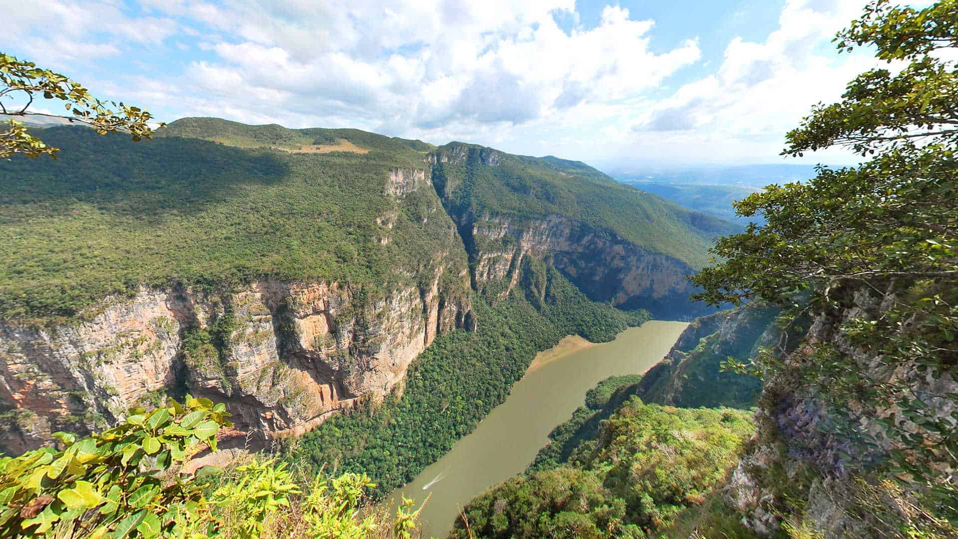
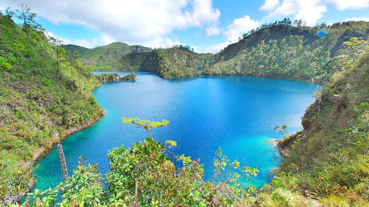
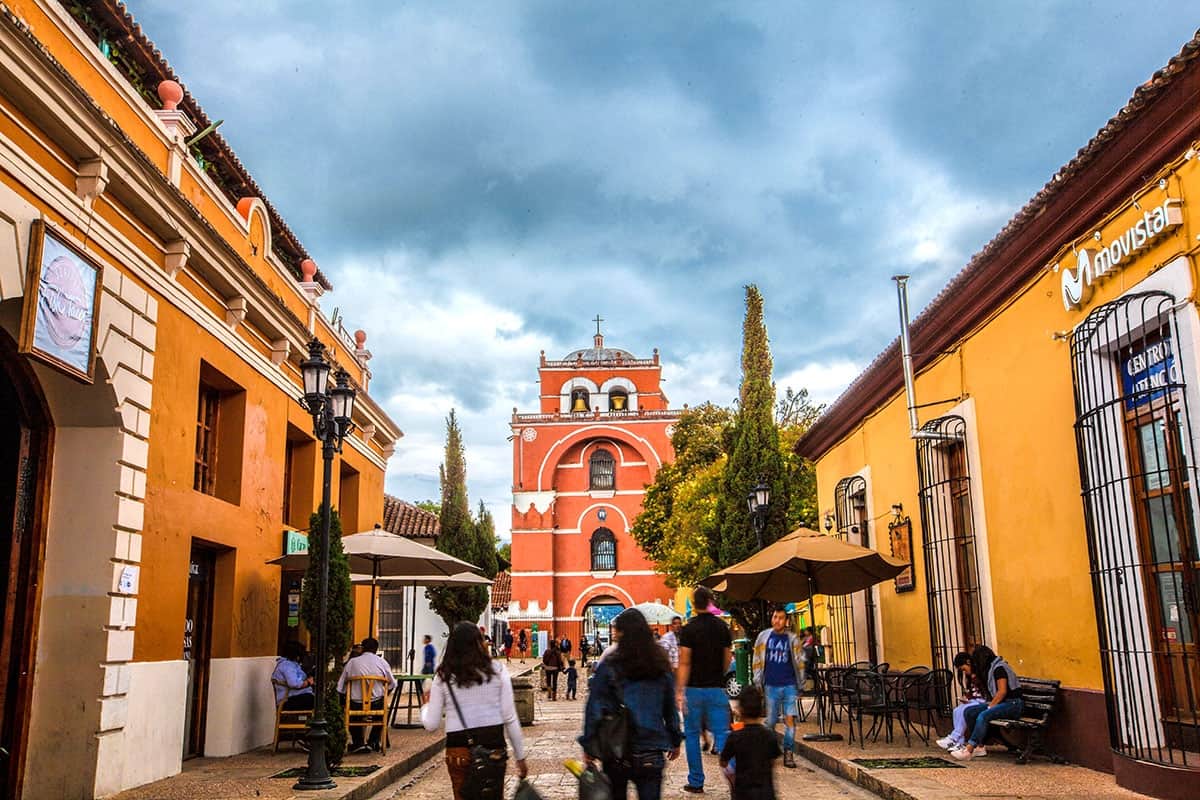
They constitute the central and elevated mountainous part of Chiapas. Its landscape is characterized by temperate forest associations. In general terms, two landscapes can be distinguished: The central highlands, such as the Jovel valley where San Cristóbal de Las Casas is located, and a high plains zone to the southeast that begins at the foot of Comitán de Domínguez, including the lake zone of Montebello. To the west, you can see how the highlands are cut by the Sumidero Canyon.
The Eastern Mountains
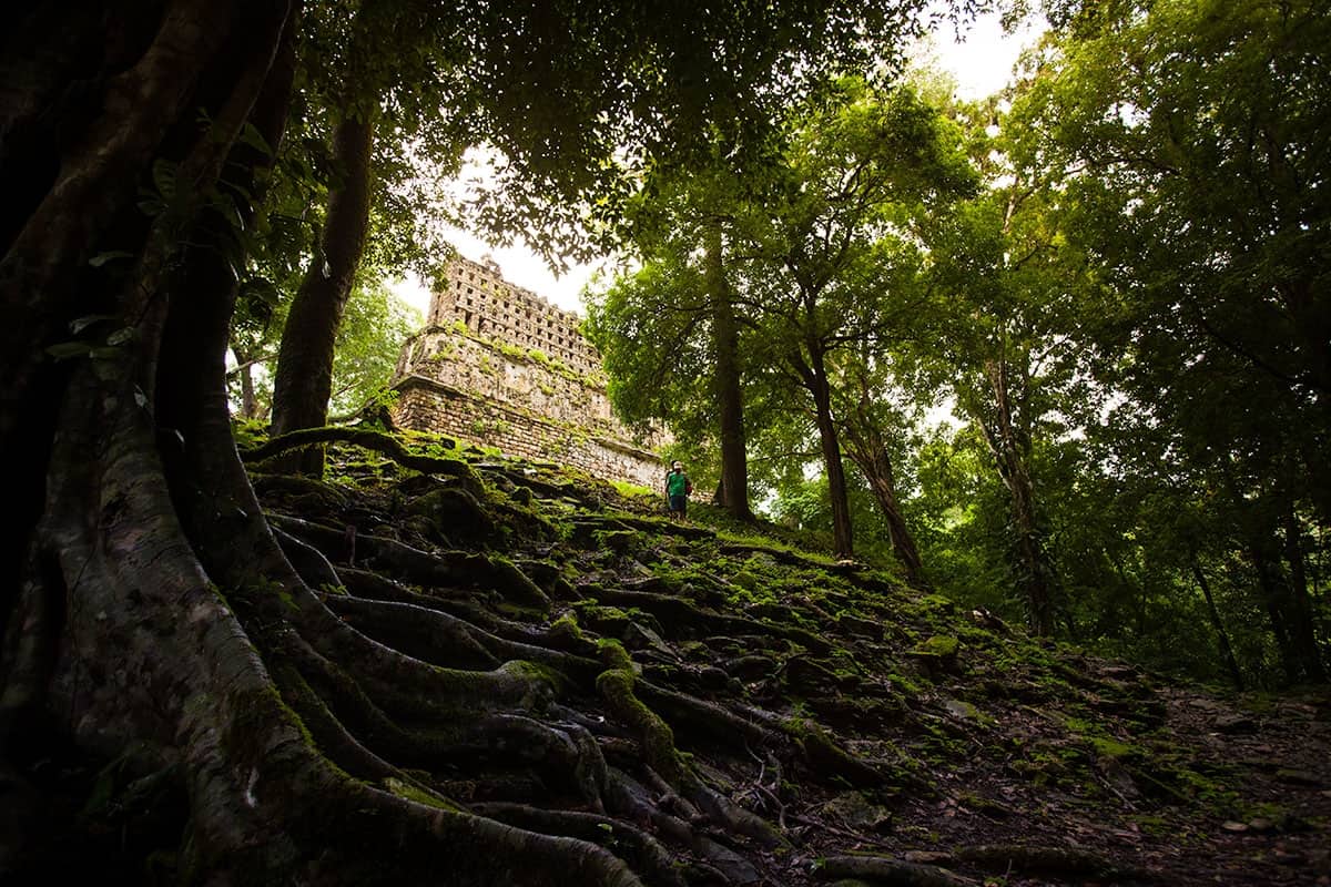
The mountains known as Cañadas, are a succession of mountain ranges, which are oriented in a northwest-southeast direction and separated by the valleys that run through the mighty rivers that feed the Usumacinta and also by lakes of karst origin (Miramar, Ojos Azules, Nahá, El Suspiro, among others). Its warm, humid and very rainy climate favors the development of the Lacandon Jungle, which is partially preserved in the Montes Azules Reserve. It is an area of great faunal richness, one of the last habitats of the jaguar and other mammals. It was also the scene of the development of great classic Mayan cities such as Yaxchilán and Bonampak.
The Northern Mountains
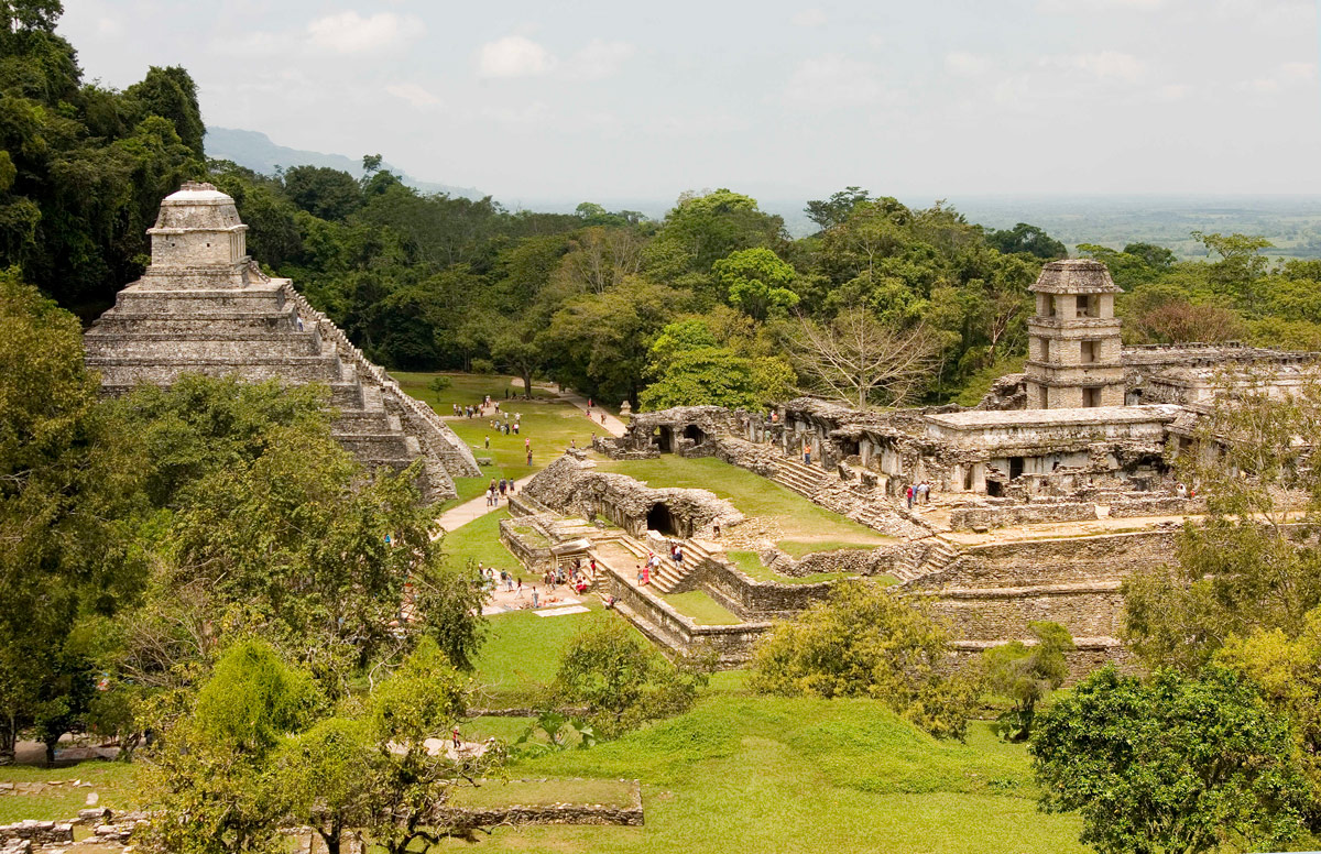
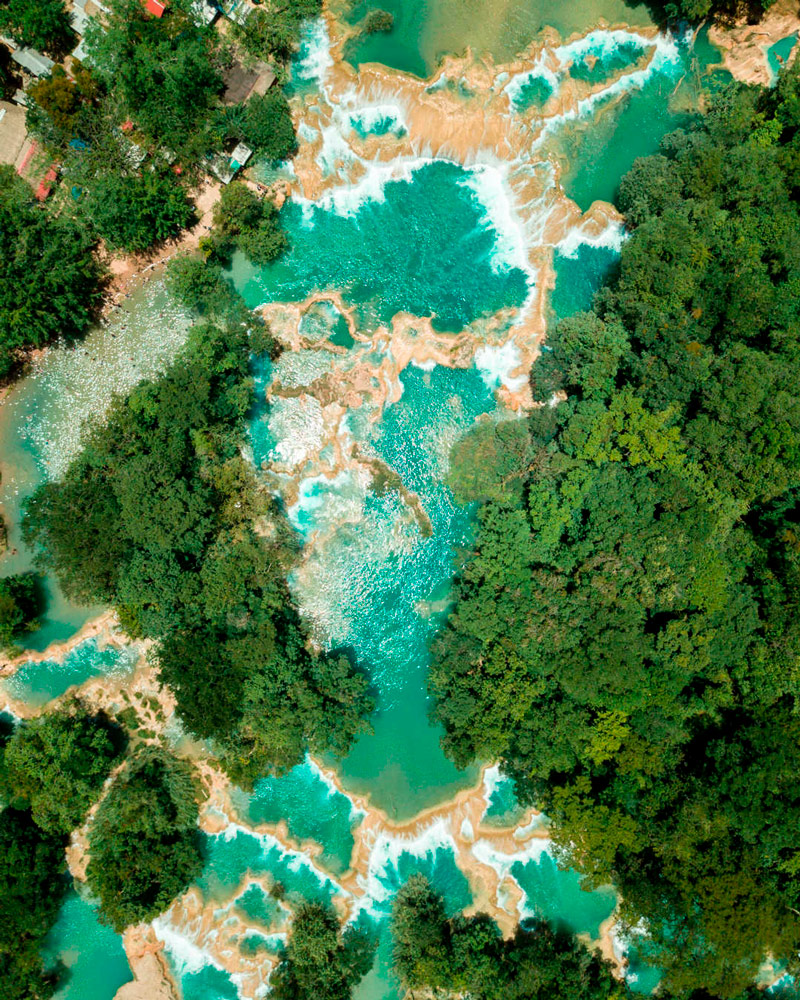
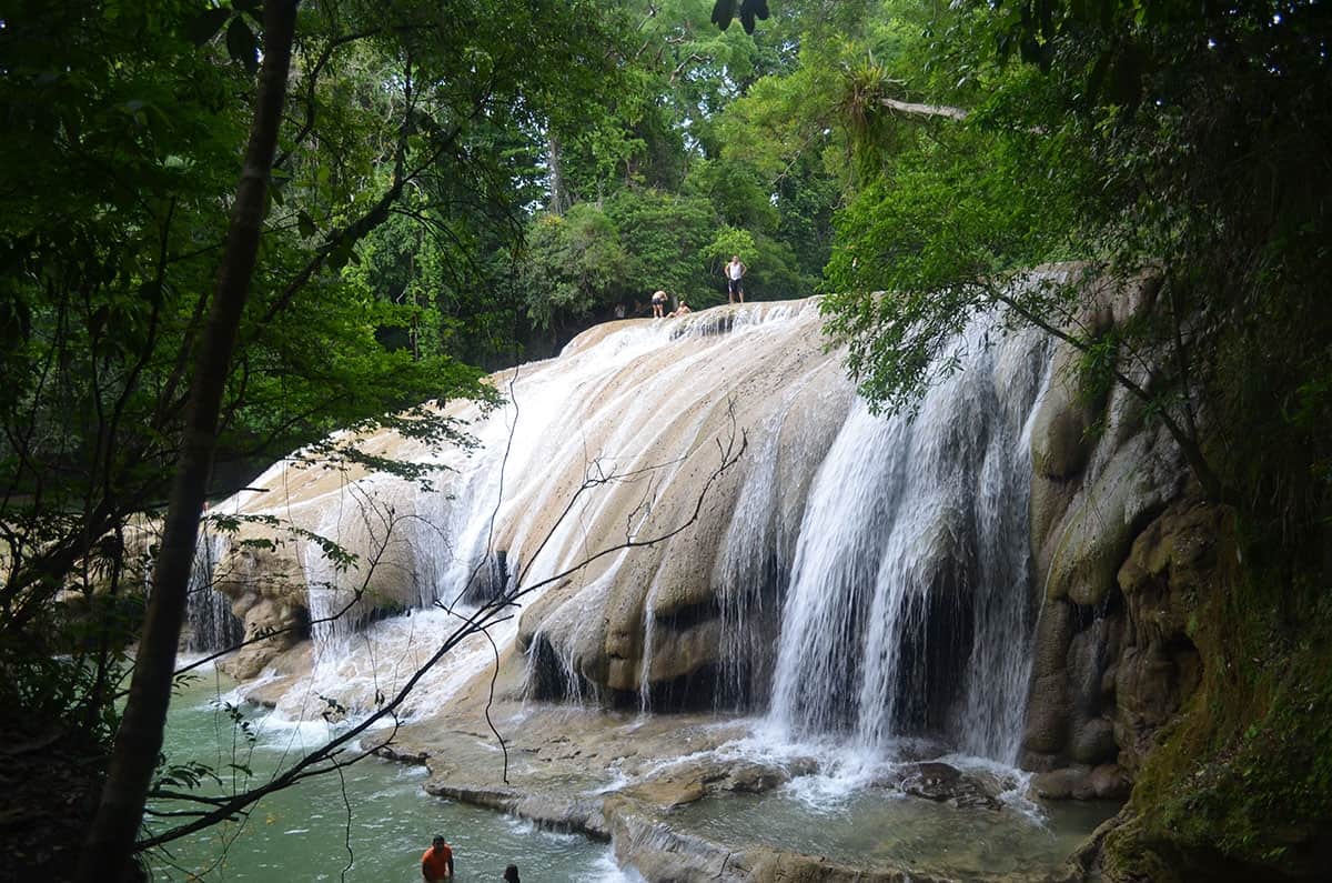
In these mountains there is an active volcanic zone represented by the Chichón. The geological origin of these mountains can be seen in the presence of amber, the fossil resin, which is considered the jewel of Chiapas. The diversity of the relief and the large hydrological network create numerous waterfalls such as the famous Agua Azul. The pre-Hispanic city of Palenque was developed on one of the steps of these mountains.
A paradise to discover at every step
Chiapas offers the visitor several destinations to know and explore its wonderful territory.